- HOME
- Things To Do
- Arts & Culture
- Art Galleries
- Art In Public Places
- Murals
- Performing Arts/Theatre
- Attractions
- Downtown Longmont
- Cheese Importers
- Cheese Making
- Hot Air Ballooning
- Mile-Hi Skydiving
- Day Trips from Longmont
- Dog Friendly
- Family Fun
- Farms & Farmer's Markets
- Longmont Farmers Market
- Farm Dinners
- Live Music
- Longmont Sunsets
- Museums & History
- Longmont Museum
- Longmont History
- Hygiene, CO
- Stephen H. Long
- J.C. Penney
- Tower of Compassion
- Teddy Roosevelt
- The Callahan House
- Ken Pratt
- Haunted History
- Sandstone Ranch
- Imperial Hotel
- Chief Niwot and the Left Hand Curse
- Dickens Opera House
- Ed Jones Building
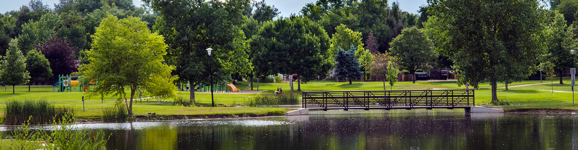
- Parks & Outdoors
- Biking
- Birding
- Dickens Farm Nature Area & Tubing
- Fishing
- Golden Ponds
- Hiking
- Lakes & Rivers
- McIntosh Lake Nature Area
- Union Reservoir
- St. Vrain State Park
- Rocky Mountain National Park
- Shopping & Entertainment
- Spend the Day in Longmont
- Sports
- Golf
- Disc Golf
- Swimming
- Water Sports
- Winter
- Top Things To Do
- Wellness
- HOME
- Restaurants
- Asian
- Bars & Pubs
- Brunch
- Coffee Shops, Bakeries, and Ice Cream
- National Coffee Day
- Indian & Nepali
- Mexican
- Featured On TV
- Farmers Markets
- HOME
- Plan
- About Longmont
- Facts & Figures
- Multicultural Heritage
- History
- Old Town Longmont
- Prospect New Town
- eNewsletter
- Itineraries
- Winter
- Spring
- Summer
- Fall
- Carbonation + Elevation
- Girl's Weekend
- Perfect Longmont Itinerary
- Moving To Longmont
- Tips For Visitors
- Visitor Center
- Visitors Guide
- Digital Visitors Guide
- Transportation
Hiking
Many outdoor hiking adventures await you in Longmont.
There are paved trails and paths for a leisure outing in city parks, greenway paths and local reservoirs as well as unpaved trails in our surrounding open spaces and nature areas for a foothills adventure in the Rocky Mountains. With our 456 acres of parks and 1,654 acres of nature areas, any route you choose will feature stunning views and your adventure can be full of peaceful serenity or adrenaline-packed fun!
Grab your Boulder County Trails App here!
View online or download Colorado's Trail Explorer
5 Must-See Hikes Near Longmont
Oh, Colorado. Where the mountains are as tall as the meadows are vast. And the weather will happily blast you with all 4 seasons in a day...
Whether you’re visiting this incredible state, or are a Longmont local who needs a few trail ideas, this guide will help you easily plan and execute your next hiking adventure.
The mountains are for everyone and the trails await!
Friendly & important reminder: we are guests in the wilderness. Always practice *leave no trace and please *follow dog leash laws. Make sure our trails stay beautiful and accessible for every adventurer who comes after us.
Here are 5 must-see hikes in the Longmont area!
1. Rabbit Mountain Open Space:
Trail: Eagle Wind Trail
Length: 3.8 mi
Elevation Gain: 470 ft
Location: Get Google Maps Directions to Rabbit Mountain Open Space Here
Difficulty: Easy/Moderate - There are specific spots on the trail with semi-tricky footing because of rocks, however, I find this trail to be easier than other moderately ranked trails.
Type: Loop
Dog Friendly: Yes, leashes required.
Entrance Fee: None
Notes: Restrooms and covered picnic tables available at trailhead.
Rabbit Mountain is always a serene experience. Located in Longmont, Colorado it is a plateau that offers unparalleled views of the front range. Because it is a plateau, the leg work is at the beginning of the hike as you ascend to the top. Then you get to wander for 3 miles enjoying the incredible landscape. Try to go on a sunny day, which is not hard in this area, to take advantage of the expansive views!
This hike is perfect every time of year. In winter make sure to bring microspikes for the initial uphill. In summer pack on the sunscreen. This is the first trail I frequented as a solo hiker in the area. It's a wonderful place to practice for longer solo hikes as well, because there is cell service for the majority of the trail.
Wildlife is thriving at Rabbit Mountain. I’ve had my fair share of fun encounters here and frequently see deer, eagles of all kinds, rabbits, and my favorite... coyotes! Rabbit Mountain is not-so-busy on the weekends and is a great hike for all reasonable ages!
2. Hall Ranch Open Space
Trail: Antelope and Bitterbrush trail
Length: 4.5 mi
Elevation Gain: 1500 ft
Difficulty: Moderate
Location: Get Google Maps Directions to Hall Ranch Open Space Here
Type: Out and back
Dog: No dogs allowed
Entrance Fee: None
Notes: Check trail conditions before leaving; trails often closed for mud.
Hall Ranch Open Space is a quick trek from Longmont, technically in Lyons, Colorado. It offers a variety of trail options and can be used year round (see notes above). The trail options can easily be made into an all day adventure, or can be turned into a pleasant out and back if looking for an easier option.
If you elect to do the full Antelope and Bitterbrush trail plan for half an afternoon. The views are incredible and in spring the land becomes vibrant and green. A spring visit is highly suggested! As always, if you visit in winter make sure to bring proper gear and microspikes.
A variety of wildlife can be seen here year round as well. Deer graze right off trail. I’ve spotted eagles, hawks, and snakes as well.
As a hiker, be sure to be on the lookout for bikers. We share the trails at Hall Ranch.
3. Button Rock Preserve
Trail: Sleepy Lion Trail to Button Rock Dam
Length: 5.4 mi
Elevation Gain: 920 ft
Difficulty: Moderate
Location: Get Google Maps Directions to Button Rock Preserve Here
Type: Loop
Dogs: One dog per visitor. Leashes required.
Entrance Fee: None
Notes: Button Rock is a great day trip for the whole family. The walkable road is easy. It follows a beautiful river. There are restrooms. Look for rock climbers by the first waterfall! *There is no swimming in Ralph Price Reservoir*
Button Rock Preserve is a short 20 minute drive from Longmont and offers a wide range of trail options for anyone looking for a low key adventure. Check out the trail map before you head out and plan your route accordingly! Every trail option is good. The trail starts on Longmont Dam Road. A quiet and easily navigable road.
You can take this road two miles to the lake (Ralph Price Reservoir), with a short quad burning 200 feet steep elevation gain at the end. Or, you can take the more scenic route! Walk one mile up the road, then veer left onto Sleepy Lion Trail. The trail is beautiful and will take you winding up the side of the mountain until you’re overlooking the lake with views of Mount Meeker and Longs Peak.
Make your way through the forest and down to the reservoir. Walk across the dam and enjoy the feeling of vastness. At the end of the dam, you’ll see the trail on the right. Take it to circle back down and create a loop. You’ll end up back on the road and have a two mile easy cruise back to your car. There is not a wrong way to do Button Rock Preserve. Go and have fun! It’s easy to navigate. Rangers love to answer questions.
No dogs allowed. And there is strictly no swimming in the lake; it serves as a water source for many people. Let’s do our part to keep Button Rock thriving!
4. Heil Valley Ranch
Trail: Lichen Loop
Length: 1.3 mi
Elevation Gain: 240 ft
Location: Get Google Maps Directions to Heil Valley Ranch Here
Difficulty: easy
Dogs: no dogs allowed
Type: loop
Entrance Fee: None
Notes: Picnic areas and restrooms available at parking area. Bring lunch and spend the afternoon!
A wonderful place to spend a summer afternoon with the whole family, Heil Valley Ranch is a short drive from Longmont. Partially wooded, offering shaded trails as well as restrooms and picnic facilities, the whole family is sure to love any time spent here.
There is a short 1.8 mile loop trail that is fit for all ages and hiking abilities. The trail winds through the forest, offers stunning views, and even has a bench at the top to sit on while you take it all in. There are connecting trails as well if you want to make a full afternoon of it. Beware of bikers on connecting trails. A family of wild turkeys lives here and can be frequently seen in the meadow. There are often coloring sheets for children offered at the start of the trailhead to keep entertainment value high. You really can’t go wrong with a visit to Heil Valley Ranch.
5. Hermit Park Open Space
Trail: Kruger Rock Trail
Length: 4 mi
Elevation Gain: 980 ft
Location: Get Google Maps Directions to Kruger Rock Trail Here
Difficulty: Moderate
Dog Friendly: Yes, leashes required.
Type: Out and back
Entrance Fee: $10/vehicle for daily permit, debit machine at entrance
Notes: Check for seasonal closures! Camping is available by reservation at Hermit Park.
Hermit Park is a stunning open space near Estes Park, Colorado. It offers a wide range of activities and is a great day trip for the family! We went in the fall and the colors were booming. Kruger Rock Trail is where you want to go. It offers incredible 360 degree views of Estes Park if you’re willing to do the moderate climb. There is a short rock scramble at the end of this trail. Whether you opt to do the rock scramble or stay at the base, the expansive views and intricate rock formations are worth the hike.
Plan to take time to relax and eat a snack when you reach the top! There may be wind so dress accordingly. Always bring layers. The more prepared you are, the more fun you’ll have! This trail has everything you need for an afternoon of adventure. Be on the lookout for elk and other wildlife! Restrooms and picnic tables are available near trailhead.
Hiking Guide photos and content by Kara Niessen:

I hope you’ll find this guide helpful in planning your next Colorado hiking adventure. If you’re on Instagram, I’d love to connect with you. Find me @kara_wandering and let’s explore together! See you on the trails soon!
Kara :)
Results